|
Iran's Weather
Iran is located in latitude 25 to 40 degrees south of the temperate zone of the northern hemisphere and also in longitude 44 to 63 degrees east. The vastness of our country in these latitudes has led to the diversity of its climate. This climate diversity is effective in the type of agricultural production, environment and ultimately the progress of our country.
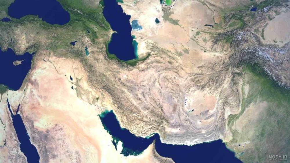
Iran is located in the northern dry temperate zone and in the middle latitude on the globe in the subtropical and equatorial region. The same geographic location, far from the big seas, especially the air currents, has caused the climate of Iran to be dry and barren, but due to its great size and the presence of various natural effects such as high altitudes in the north and west and vast lowlands, such as the plains Centered inside the plateau and in addition to that, the vicinity of the Mazandaran Sea and the Persian Gulf and the Indian Ocean - each of these horizons create a separate climate, Iran has a different climate and a diverse climate.
Iran is a high plateau, close to the vast plains of Asia, whose average height is about 1200 meters above sea level. The folds and heights, some of which are more than 4,000 meters high, and the presence of the north and south seas that are far from the central areas, especially the location of the mountains that surround Iran, make this country one of the rare countries in the world. It is known that you can witness all kinds of weather in it.
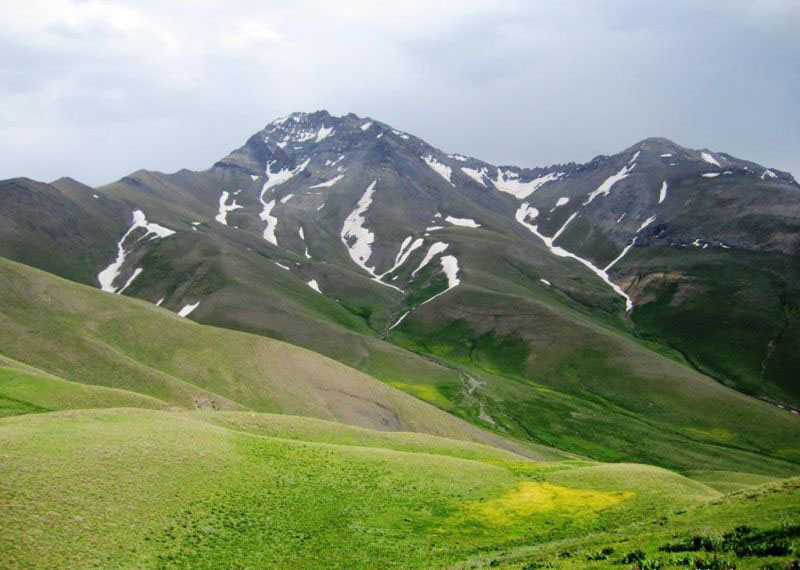
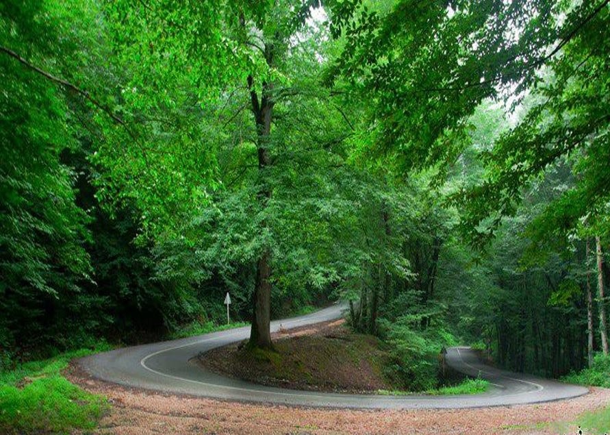
The height of the mountains of Iran is so high that it prevents the influence of the humid winds of the Mazandaran Sea, the Mediterranean Sea and the Persian Gulf in the inner regions of Iran. For this reason, the outer slopes of these mountains have a humid climate and the inner slopes are dry. In the southern shores of the Mazandaran Sea, the climate is moderate and the amount of rainfall is higher, especially on the west coast of Gilan, than in other places. The average annual temperature is around 18 degrees Celsius. 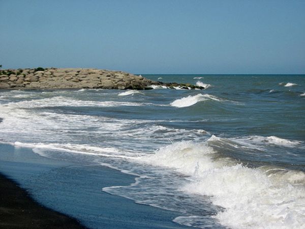
The climate of the western part of the country is Mediterranean, and in its southern regions, the warm semi-desert climate also affects it. In these areas, summers are accompanied by harsh heat in the valleys and moderate weather in the highlands, and in winters, moderate weather prevails in the valleys and severe cold in the highlands.
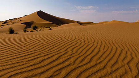
In the southern regions, despite the humid weather that prevails throughout this region, the temperature is high, so that the maximum temperature in Khuzestan reaches 54 degrees Celsius. One of the characteristics of this region is hot summers and mild winters, and the temperature difference in different seasons and day and night is not much. Due to the presence of Alborz mountains in the north and Ebersan mountain ranges in the west of the country, the interior areas of the Iranian plateau have a dry and desert climate.
(Division of Iran's climate)
The factors that create Iran's climate can be divided into two internal and external categories:
The country of Iran, due to its large width and the existence of many mountains that cover it, as well as hundreds of thousands of square kilometers of desert lands and the proximity to two large seas in the north and south (internal factors) and also due to being relatively close to Europe and The Mediterranean Sea and the great desert of Africa and the Indian Ocean and the inner highlands of Asia and the vast cold land of Siberia (external factors) have such diversity in climate that is seen in few countries. The air temperature varies from less than -30 (Ardebil) to more than 60 degrees Celsius (some southern regions or central deserts of Iran) and its average annual rain varies from less than 5 cm to nearly 2 meters and in It is among these variables that the effects of internal and external factors create many and diverse climates.
Latitude and altitude are the most important factors of climate change in Iran. The southernmost point of Iran is only one to two degrees away from the Tropic of Cancer, and as a result, the southern regions of the country are hot all year round. On the other hand, in the northern parts (with the exception of the Caspian coasts, which are affected by that sea), as well as in the mountains, heat rarely occurs in the summers, and they often have frosts every day for 3 to 4 months of the year, that is, cold below zero.
The effect of distance and proximity to the sea can be well understood by comparing the abundant rain and rich vegetation and human conditions of the shores of the Caspian Sea with the dry, waterless, grassless and uninhabited deserts of central Iran. The extension of the mountain ranges and their location in front of or parallel to the winds and air currents are also factors that are always effective in changing the weather. In the mountain ranges that are in front of the humid winds, there is a big difference in the amount of rain and vegetation between the slopes facing the wind and facing the wind.
The temperature difference between the coldest and hottest parts of Iran is great. When the weather is cold in the northwest and west of the country, hot weather is seen in the south of the country. Our country has a variety of climates. While the life of the people of Ardabil is mixed with snow and cold, the coastal residents of the Pars Sea and Oman Sea may not see snowfall in their place of residence for years. Or when the people of Bandar Anzali have more than 1800 mm of rain in a year, the people of Mirjaveh in Sistan and Baluchistan province have less than 50 mm of rain. This variety of weather has caused diversity in the natural and cultural landscapes of Iran, which is seen in few countries in the world;
In such a way that our Iran is known as the country of four seasons. 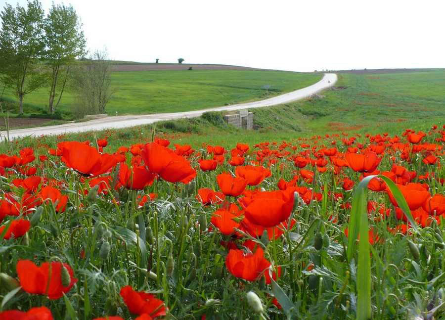
About 90% of the country's soil is located in the Iranian plateau.
More than half of the country's area is mountainous and highlands, a quarter of it is plains, and less than a quarter of it is cultivated land. The lowest internal point with a height of 56 meters is Chale Lut and the highest is Damavand Peak with an altitude of 5610 It is located in the middle of the Alborz mountain range.
The change of seasons and the number of seasons are related to the positional movement of the earth and its translational movement, and it can be different depending on the location of the country on the planet. The country of Iran is located in the middle part of the globe, and for this reason, the amount of sunlight in this region is high, and we see more seasons. The closer we get to the northern and southern parts of the globe, the amount of sunlight decreases and the number of seasons decreases.
For this reason, Iran is called the country of four seasons, which has different weather in different regions of Iran at one time of the year, for example, in winter in cities like Ardabil, the weather is extremely cold and snow covers everywhere, but in At the same time, if you travel to cities in the south of Iran, it has summer weather, and if you travel to other cities in the east, it has autumn weather.
Three types of weather can be distinguished in Iran:
A. Desert and semi-desert climate: large parts of the interior lands and southern sides of Iran have this type of climate. One of the characteristics of this type of climate is the existence of a long dry heat period, which sometimes covers more than seven months of the year. The annual rainfall in these areas varies between 25-30 mm.
B. Mountain climate: which itself is divided into two types of cold mountain climate and moderate mountain climate.
• The cold mountain climate that occupies about 40,000 square kilometers of Iran. The annual rainfall in these areas is more than 500 mm.
• The mild climate of the mountains, which occupies about 300,000 square kilometers of Iran's soil, and its annual rainfall varies from 250 mm to 600 mm.
C. Caspian climate: which is a narrow and small area between the Caspian Sea and the Alborz mountain range, with an annual rainfall between 600 and 2000 mm.
Factors affecting Iran's climate
In general, the causes of the country's climate diversity can be analyzed in three geographical factors:
1- Geographical location
Latitude, high pressure near the tropics and distance and proximity to the seas; The most important factors are the geographical location that affects the country's climate.
A) Latitude: In the southern regions of the country, which are located in low latitudes (closer to the equator), the angle of the sun's rays at noon is close to vertical, and for this reason, in these areas, the amount of solar radiation is higher and the air it is warmer; Like the provinces of Hormozgan and southern Sistan and Baluchistan, but in the northern regions of the country, which are located at high latitudes and the angle of the sun's radiation is more inclined, the amount of radiation is less and the air is colder; Like the provinces of West and East Azerbaijan in our country, on average, the temperature increases from north to south.
b) Iran's location in the subtropical high pressure belt: around the equator due to the warm and rising air, the low pressure belt of Hazai is formed and has a warm and humid climate. Around the orbit of Ras al-Karam and Ras al-Jadi, due to the heaviness and subsidence of the air, a subtropical high-pressure belt is formed and it has a hot and dry climate that prevents the air from rising and forming clouds and rain. The most important dry and desert belts on the planet have been created due to the high-pressure factor near Hazai, and our country is located inside this dry belt. The subtropical high pressure factor moves into the country in the summer and prevents rainfall in the country during the hot period of the year.
2- The height and direction of the mountains
With every 1000 meters of altitude increase, the air temperature in the troposphere layer of the earth's atmosphere decreases by an average of about 6 degrees Celsius. So, in the mountainous regions of the country, the weather is colder and in the interior plains of the country, which have a lower altitude, water and The weather is warmer. The direction of the high mountain ranges like Alborz and Zagros also affects the geographical distribution of the country. This factor has caused more rains in the northern slopes of Alborz and the western slopes of Zagros.
3- Entry of air masses into the country
An air mass is a large volume of air whose physical characteristics, especially in terms of temperature and humidity, are almost the same on a horizontal surface for hundreds of kilometers. Throughout the year, all kinds of air masses enter our country and affect Iran's climate. These masses include the western air mass, the Siberian air mass, the Sudanese air mass, the hot and dry air mass, and the humid monsoon air mass.
Some regions of Iran are more populated than other parts. The urban area of Tehran, the provincial centers of the country, the western half and the northern half of the country have more population. In our country, Iran, there is a region that is empty of population. This is due to unfavorable weather conditions and living conditions. These are the plains of Lut and most of the coasts of the Oman Sea and the interior parts of the desert plains and very high mountain areas.
|